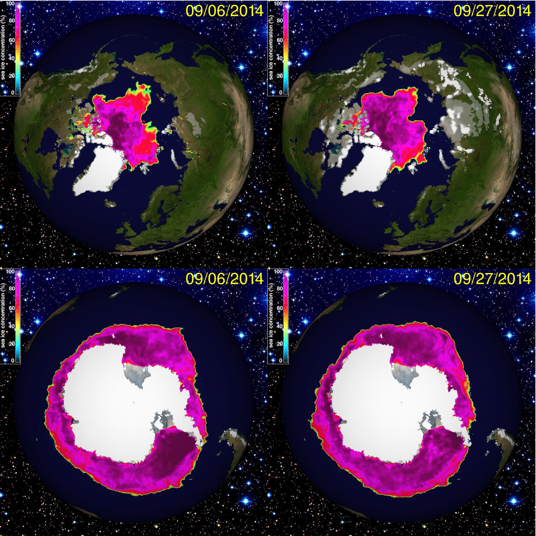
Changes in the last month: Arctic: Although we have passed the equinox and the sea ice is growing again, you can see a decrease if you compare the two September 2014 pictures. The minimum was probably on September 17th with 5'200'000km2, which is the sixth-lowest on record. (The 1979 - 2000 average was 6'700'000km2) Note that in many parts of Siberia there is already a snow cover, also in parts of Alaska and northern Canada - and a little bit in Norway. Antarctica: Interestingly the Antarctic maximum doesn't coincide with the Arctic minimum: it is a bit later; at the moment it is too early to determine, we will see next month. You can see some differences which mean probably thousands of km2 and are partly due to wind and sea currents, but notwithstanding this satellite images report a new maximum record of sea ice around Antarcitca: for the first time in the last 35 years of modern satellite images it is more than 20'000'000km2! It seems that many climate models predict such a short-term increase in Antarcitc sea ice (which doesn't make up for the loss in the Arctic). Pictures with the friendly permission of the Polar Research Group > Department of Atmospheric Sciences > University of Illinois; arctic.atmos.uiuc.edu