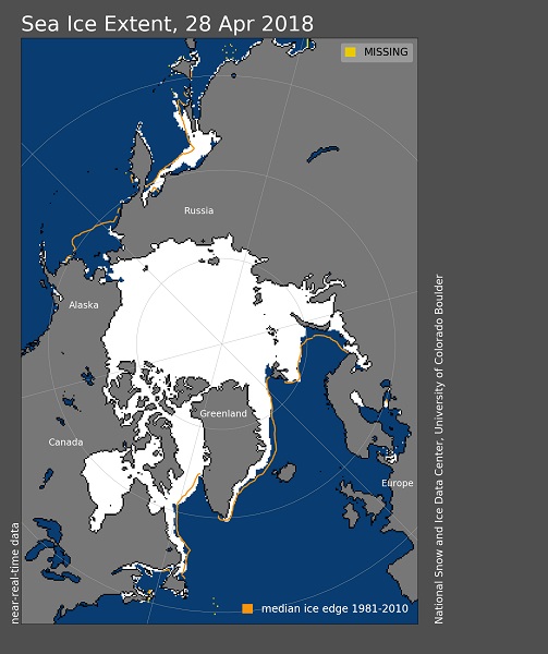
April 28th, 2018: Arctic sea ice extent ********************
Arctic sea ice extent for April 2018 averaged 13.71 million square kilometers (5.29 million square miles). This was 980,000 square kilometers (378,400 square miles) below the 1981 to 2010 average and only 20,000 square kilometers (7,700 square miles) above the record low April extent set in 2016. Given the uncertainty in measurements, NSIDC considers 2016 and 2018 as tying for lowest April sea ice extent on record. As seen throughout the 2017 to 2018 winter, extent remained below average in the Bering Sea and Barents Sea. While retreat was especially pronounced in the Sea of Okhotsk during the month of April, the ice edge was only slightly further north than is typical at this time of year. Sea ice extent in the Bering Sea remains the lowest recorded since at least 1979. The lack of sea ice within this region created many coastal hazards this past winter. Overall, sea ice extent for April 2018 declined by 920,000 square kilometers (355,000 square miles). The amount of ice lost for the month was less than the 1981 to 2010 average of 1.1 million square kilometers (424,700 square miles). The ice edge retreated everywhere except in Hudson Bay and Baffin Bay/Davis Strait. The sea ice expanded slightly within Davis Strait during the month. Sea ice in the Hudson Bay usually does not begin to retreat until the end of May.
Image courtesy of the National Snow and Ice Data Center, University of Colorado, Boulder (https://nsidc.org/arcticseaicenews/). Data source see http://nsidc.org/arcticseaicenews/about-the-data/