March 29th, 2020: Antarctic sea ice extent ***********************
No record-breaker maximum
March 24, 2020
Arctic sea ice appears to have reached its annual maximum extent on March 5. The 2020 maximum sea ice extent is the eleventh lowest in the 42-year satellite record, but the highest since 2013. The Antarctic minimum sea ice extent, which was noted in the previous post, was indeed reached on February 22. NSIDC will present a detailed analysis of the 2019 to 2020 winter sea ice conditions in our regular monthly post in early April.
On March 5, 2020, Arctic sea ice likely reached its maximum extent for the year, at 15.05 million square kilometers (5.81 million square miles), the eleventh lowest in the 42-year satellite record. This year’s maximum extent is 590,000 square kilometers (228,000 square miles) below the 1981 to 2010 average maximum of 15.64 million square kilometers (6.04 million square miles) and 640,000 square kilometers (247,000 square miles) above the lowest maximum of 14.41 million square kilometers (5.56 million square miles) set on March 7, 2017. Prior to 2020, the four lowest maximum extents occurred from 2015 to 2018.
The date of the maximum this year, March 5, was seven days before the 1981 to 2010 median date of March 12.
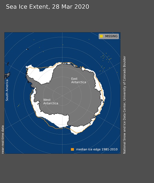
Image courtesy of the National Snow and Ice Data Center, University of Colorado, Boulder (https://nsidc.org/arcticseaicenews/). Data source see http://nsidc.org/arcticseaicenews/about-the-data/