I am starting a new SIMB study site today, the first day of July 2018. I think I have found a spot that has good access that is quite representative of the central Oregon coast and a decent selection of native plants.
Location:
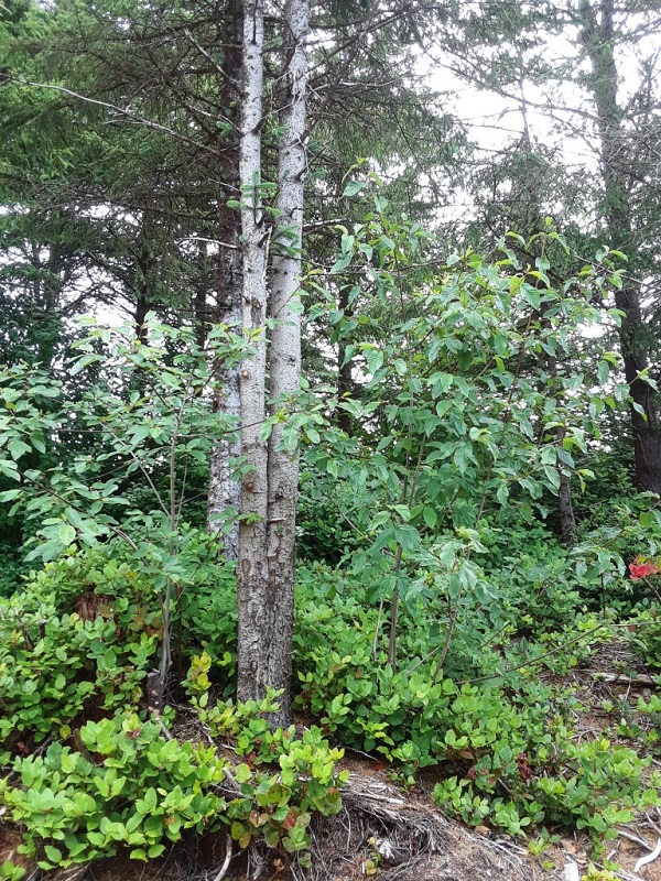
Images taken of this site will be facing East.
The coastal forest ecosystem is dominated by the conifers Sitka Spruce (Picea sitchensis), a variety of Lodgepole Pine commonly called Shore Pine (Pinus contorta contorta), and Western Hemlock (Tsuga heterophylla). As one travels east, away from the ocean, you also start seeing more Douglas Fir (Pseudotsuga menziesii) and Western Redcedar (Thuja plicata). The most common desciduous tree in this area is Red Alder (Alnus rubra).
Climate Summary:
(from usclimatedata.com which shows summaries based on 30 years of climate data)
Newport, OR
Annual high temperature 58.5 F (14.7 C)
Annual low temperature 44.1 F (6.7 C)
Average temperature 51.3 F (10.7 C)
Average annual precipitation 69.57" (1767.07 mm)
As you can see, the temperatures are mild but the precipitation high. The above averages do not show that there are almost always a few days in December or January where the temperature does drop below freezing and even snow or ice occasionally falls.
Additionally, I should mention that almost 50% of the annual precipitation occurs during November, December and January; and close to 90% of the annual precipitation during October through May. Summers are typically dry, although not always hot due to coastal fog. Interestingly, the incidence of fog is often tied to how hot it gets 50-60 miles inland in the Willamette River valley: the hotter the weather inland, the higher the incidence of coastal fog. I will try to remember to explain this phenomenon more in future monthly reports.
USDA Plant Hardiness Zone:
The US Department of Agriculture has established Plant Hardiness Zones throughout the USA. These zones are based on the annual minimum winter temperature, divided into 10 degree F zones. To see a map of the US zones, go to http://planthardiness.ars.usda.gov/PHZMWeb/
You can select Oregon to see a map of the hardiness zones for the state and for Newport/ South Beach, enter the zip code 97366
Our USDA Plant Hardiness Zone is 9a (minimum temperature 20 to 25 F or - 6.7 to -3.9 C)
Tides (1 July 2018):
Since the ocean is so close, only about a 5 minute walk from the study site, it seems applicable to include the tide tables for today:
2:24 am high 7.75 ft (2.36 m)
9:09 am low - 0.71 ft (- 0.21 m)
3:58 pm high 6.77 ft (2.06 m)
9:13 pm low 3.16 ft (0.96 m)
The measurements in feet (and meters) describe the estimated distance above and below the average low water mark, called the Chart Datum. Of course, these are only predicted measurements and are influenced by weather, such as storm surges. It is interesting to watch on a daily basis how the heights change, especially as the moon phases change and as the seasons change since the tides are affected by the moon and sun, as well as by local currents and winds. (Perhaps this would also be an interesting topic for more discussion in a future report.)
Sunrise/ Sunset (1 July 2018):
The sun rose today at 5:35 am and will set at 9:05 pm. This gives us a total day length of 15 hours 31 minutes. Solar noon occurred at 1:20 pm.
Weather today at solar noon: partly cloudy (50% overcast), stratus clouds (fog), clearing. Temperature 64.4 F (18.0 C). Overnight we had light precipitation and there was 0.6 mm of rainfall in the rain gauge.